Northern Coast Lighthouses: Beacons Through Weather and Time

Explore the towers, keepers, and shoreline landmarks that guided northern waters and still shape coastal memory today.

  • Archival photographs
  • Keeper accounts
  • Preserved landmarks

Coastal chronology

How the northern coasts beacon chain took shape

From improvised lamps on exposed headlands to restored towers watched over by local stewards, lighthouse building followed wreck years, harsh weather, and the daily work of keepers who turned scattered points of light into a recognizable coastal system.

  1. 1820sEarly beacons: Harbor communities raised fixed oil lights on cliff edges where sandbars and fog hid the shoreline at night.

  2. 1860sStone tower era: After repeated winter losses, engineered masonry towers and Fresnel lanterns established a safer, farther-reaching night route.

  3. 1910s1930s: Keeper walkways, signal routines, and supply paths linked previously isolated stations into a coordinated coastal watch.

  4. 1970sToday: Automation ended resident staffing, and preservation groups reopened surviving lights as working landmarks and public memory sites.

Keeper Stories

Lives behind the lantern glass

Across logbooks, supply notes, and weather margins, the towers read less like monuments and more like homes shaped by routine, risk, and long horizon days.

Storm watch

When the glass began to sing

Before the squall reached the bay, keepers wrote of a high whine through the lantern panes and the smell of wet rope in the stairwell. By dusk, every hinge was checked twice and the beam held steady through spray.

Trace related archive marks
Family quarters

Bread tins by the chart table

In winter months, domestic life moved quietly between lamp duties: boots drying by iron stoves, school copybooks beside tide charts, and supper timed to the interval between signal checks.

Return to the broader timeline
Winter lamp rounds

Four flights before dawn

Ice along the outer rail turned each pre-sunrise climb into deliberate work. Entries from January describe trimmed wicks, thawed fittings, and a practiced silence broken only by gulls and the clockwork drive.

Locate towers tied to this routine

Archival signal marks once used to index districts, relay routes, and lighthouse records along the northern coast.

  • NR-01
  • WT-03
  • HB-07
  • DT-11
  • RN-14
  • CL-18

Preserved towers

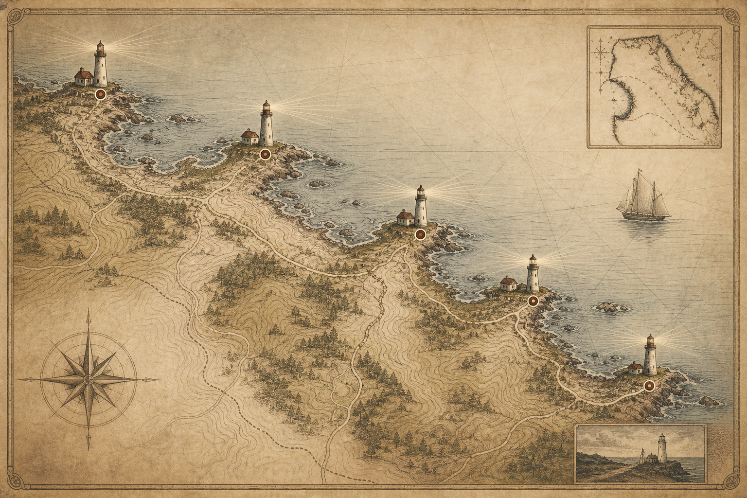
Northern coast lighthouse map

Trace the surviving beacons from headland to harbor and follow how each station shaped navigation along the shoreline.

Stylized printed cartography map of the northern coastline with preserved lighthouse markers, contour lines, and beacon rays

Visiting notes

Plan a respectful lighthouse visit

Quick answers on access, conditions, and where to keep learning before you head out.

Can I access every lighthouse site directly?

No. Some towers are on protected land or private approaches. Use posted trailheads, municipal access notes, and marked overlooks when direct entry is restricted.

How exposed are these coastal locations to weather?

Very exposed. Wind can shift quickly, spray can make stone and timber slick, and fog reduces visibility. Bring layers, stable footwear, and extra time for slower footing.

What seasons are best for viewing and photography?

Late spring through early autumn offers longer light and safer paths. Winter visits can be dramatic, but daylight is short and conditions are harsher, so plan conservatively.

How should I behave around preserved structures?

Stay on marked paths, avoid climbing railings or stonework, and never remove fragments. Quiet visits, careful footing, and leaving no trace help keep fragile sites intact for study.

Where can I continue archival research after my visit?

Continue with the archive marks, cross-check locations in the preserved tower map, and compare accounts in keeper stories.